(It turns out this strip is one from a series that do cross-reference and play off one another somewhat. Probably you’d agree that the context doesn’t help that much; but those who disagree are welcome to pump the other steps in the series into the comments here.)

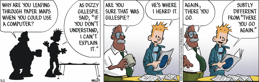
I’m too lazy (or rather, disinterested) to look up whether Dizzy Gillespie ever really said anything like what Frazz quoted, but I am very glad that I took the trouble to leaf back to the start of the series (on Monday 27-Feb-2023), because I was about to suggest a “better” quote, only to discover that it was already used on the very next day:
LikeLike
P.S. Frazz is another strip that I prefer to read through a (very narrow) filter, set to “good enough that someone else thought it was worth submitting to CIDU“.
LikeLike
I’m not entirely sure of the meaning of “Again, there you go”, or even “There you go” in an earlier strip, in this context. But whatever it is and however it differs, and with the danger of slipping towards p*litics, perhaps the “Subtly different from ‘There you go, again'” comment is a reference to Reagan being dismissive of Carter in a Presidential debate in 1980, which has continued to have currency: https://en.wikipedia.org/wiki/There_you_go_again
LikeLike
Two comments of mine in a row have just been held up.
LikeLike
I thought it was Louis Armstrong who said of swing that if you don’t understand, it he can’t explain it.
But it may have been Gillespie.
I think “Again, there you go” is implying “Here’s another case where it’d be more useful to look it up on a computer.”
LikeLike
I still like to look at paper maps, if only to see what I am IN RELATION to other places. GPS and google maps are too restrictive, too focused.
LikeLike
@ Andréa – Now that you mention it, I wonder whether we still have our trusty auto-atlas in our car. If so, I know where it would be (in the pocket on the back of the passenger’s front seat), but I’m sure we haven’t actually looked at it in the last three years. All our recent vacations have been domestic, using mobile apps for navigation.
LikeLike
Nwrmitaj, I found (and released) just one.
LikeLike
I wonder what happened to the other one? It was a comment about old paper maps and how they are not just aids to travelling in space but also in time.
LikeLike
Sorry, Narmitaj, I just can’t tell. I sometimes lose a comment (on other sites, but sometimes even here), prior to submitting it, if I am working on my iPad with wirtual keyboard, rather than the real computer. It happens with unintentionally switching to another browser tab, or worse, hitting the browser Back button, or Reload.
LikeLike
That is EXACTLY where our State Farm freebie atlas is stored . . . it has to be at least nine years old by now, as that’s when we moved to FL and used it.
LikeLike
I’ll try again as an experiment, hope the first version, which had the wrong map scale, doesn’t re-appear! (I didn’t keep this comment, but on hitting the browser back button a few times I could find it in the WordPress holding pen it puts me into after hitting Post Comment on the CIDU site).
—
LikeLike
I resubmitted my map comment a couple of minutes ago, with an extra line or two, but that also hasn’t shown up. Maybe it is too long, or too soon since the previous one.
LikeLike
Okay, one is in Spam. It should appear shortly. The one with quoted material in “code” font — and not getting broken into lines correctly.
LikeLike
Thanks! I don’t know why it is in “code” font with the lines unbroken… the comment spent time in Text Edit (Mac basic text editor), but in Helvetica font with the lines breaking dynamically wherever the edge of the frame is.
LikeLiked by 1 person
OK, I tried to repost narmitaj’s comment to remove the code font effect, but it landed in moderation (possibly because I had the temerity to mention the ineffable word “m.a.r.k.d.o.w.n.”)
LikeLike
No one really answered the difference between the two, so I’ll take a shot at it: “Again, there you go” is saying “That’s it. Right there,” maybe implying agreement, but maybe pointing out “you’re doing exactly what I was talking about.” “There you go again” could also be “doing exactly what I was talking about,” but sounds more critical, and almost implies an eye-roll expression.
LikeLiked by 2 people
The filter has become very over active today.
LikeLike
@chemgal, thanks for addressing the actual question!
LikeLike
I prefer an unfoldable paper map
So, is that a map that is able to be unfolded, or is that a map incapable of being folded, eg: laminated?
LikeLike
@Narmitaj, the
codemarking is more than a typeface choice, it is an HTML code tag, which also affects formatting. It will not insert line breaks but will keep those “hard” CRLFs that are in the text. It’s likely that Text Edit was only visually wrapping the text for you, and not inserting hard returns — which would have been fine with WP had it not been for the code format. I can’t guess what produced that — possibly backticks if you used those?I’ve copied your “code” text and pasted to Windows Notepad, where it looks alright. Let’s see how it goes with WordPress, in a moment (and different comment).
LikeLike
I said “I’ve copied your “code” text and pasted to Windows Notepad, where it looks alright. Let’s see how it goes with WordPress, in a moment (and different comment).”
So that’s this one. Let’s see …. (I’m not going to add another layer of quotation marks or formatting. The remainder of this comment is narmitaj’s text)
I’ve been looking at the odd old map recently while going through my late parents’ things. As a trainee RAF pilot in 1941 and then instructor 1942-1944 in Canada, my father was issued various regional maps overprinted in red with Air Navigation Edition information specific to aircrew, such airfields, radio beacons, lines of equal magnetic declination, civil airway corridors and so on.
Only today I discovered a large* US Air Force Air Navigation Map from 1953 (NS-140, England to Pakistan, 1:5,000,000 scale), published by the USAF Aeronautical Chart and Information Center in St Louis, Mo., covered with all sorts of useful information about prohibited flying areas and radio beacons. My father had marked in pencil various of his civil flying routes in the 1950s and 60s, eg 1) from London via the Middle East and off the page towards Delhi and Calcutta (en route to Singapore) in the early-mid 1950s with a company called Airwork; and 2) various local routes from the base in Kuwait to Cairo, Damascus, Beirut, Bahrein [sic; Dibai, also sic, is also marked but as a tiny place] when he was flying with Kuwait Airways from 1956 on.
That kind of physical artifact from 70 years ago means you sort of time-travel as well as wander over thousands of miles. There’s the USSR on there, of course, and another blast from the past is a pencilled route from Kuwait to Jerusalem, which Kuwait Airways could fly to up to 1967 I guess, when Israel annexed the West Bank.
I like paper maps. I use satnav for driving new places, of course, but if I am walking in the countryside I prefer an unfoldable paper map that shows you the context of the landscape you’re in at a glance. Similarly it is far easier to skim through a paper newspaper than an online one. You feel that people who grow up using only apps are being told very precisely how to get where they are going, but at any one time they have little idea where they are and what’s nearby.
*5 foot by 2 foot 7, which is quite big to open up in an aeroplane cockpit. Though in the 1950s aircraft often had dedicated navigators with their own table.
(My first comment had a lot of quotation marks in it (three sets, at least) and this one had one in the size measurements of the map; I wonder if that triggers the spam filters? So I took it out here, which is why 5 foot by 2 foot 7 is spelt out so oddly)
LikeLiked by 1 person
@ Danny – Congratulations, you seem to have been a lot luckier with the filters than narmitaj and I were. (My guess about the footnote characters was not correct.)
LikeLike
Yes, I didn’t do anything special with the asterisks.
Some of us, me included, use that “code” format for the sake of a different-looking typeface and shading, to mark quoted material that really should be BLOCKQUOTE. But the template makes a badly oversize and ugly BLOCKQUOTE, so this is one workaround.
But “code” is html and is meant for code. So it is notionally correct to not fold lines, as the line breaks are usually significant in actual code of most kinds. I haven’t checked, but probably whitespace is preserved too. Both of these are of course not great for flowing text meant for reading ordinary language.
LikeLike
Related quotes: Attributed to Miles Davis: “If you have to ask, you’ll never know.”
I can’t remember who it was who said, “If you don’t know by now, you’ll never know,” supposedly in answer to the question “What is swing?” But searching for “If you don’t know by now, you’ll never know” brings up a song by a rap artist, Masta Killa.
And then there’s the cover of R. Crumb’s Zap Comix No. 1.
Old lady: “I wish someone would tell me what diddy-wah-diddy means.”
Mr. Natural: “If you don’t know by now, lady, don’t mess with it.”
LikeLike
As long as we’re doing quotes, here’s one from Steven Wright:
“I have a map of the United States… Actual size. It says, ‘Scale: 1 mile = 1 mile.’ I spent last summer folding it. I hardly ever unroll it. People ask me where I live, and I say, ‘E6.”
LikeLiked by 1 person
In “Blackadder Goes Forth“, Captain Darling once showed General Melchett a table covered with green sod, explaining it was a map of the territory recently taken from the enemy. Melchett then asked, “What’s the scale of this map?“, to which Darling replied, “One to one, sir.”
Melchett: “So the amount of land we won was?”
Darling (after measuring the table with a ruler): “Seventeen square feet, sir.“
LikeLike
A 1955 GOON SHOW episode “Napoleon’s Piano”) back in the 1950s used the “gigantic map, one to one ratio” joke:
http://thegoonshow.net/scripts_show.asp?title=s06e04_napoleons_piano
Eidelburger:
Now Neddie, this is the map plan of the Louvre and the surrounding streets.
FX:
[Paper unfolding. Continues under following dialogue]
Seagoon:
Now… you take one end of this map… That’s right… unfold it… That’s the way… aha… mmm… that’s right… there we go… yes… mmm hmmm… keep going… yes… It’s big, isn’t it?
Eidelburger (far off):
Yes, it is. This bit here shows the Rue de la Pays.
Seagoon:
Good heavens, you’re miles away! Walk straight up that street, take the second on the left, and I’ll be waiting for you.
Grams:
[Car driving by at speed, then screeching to a stop]
Eidelburger:
I took a taxi – it was too far.
LikeLike
Seagoon: Now, which room is this piano in?
Gryptpype-Thynne: It’s erm… It’s in the Louvre.
Seagoon: Strange taste you have.
LikeLike
And speaking of maps and distances, I forget which episode of the Goon Show this was in:
Someone: “We can’t get there, it’s ten thousand miles away!”
Seagoon: “Just a minute …”
[Footsteps running, fading out. Footsteps running, fading in.]
Seagoon [out of breath]: “Yes, it’s exactly ten thousand miles.”
LikeLike
…oh! Because the last three letters are (almost) silent!
LikeLike
There was a TV show, for which I can’t remember the name. In it a character had unfolded a large map and couldn’t get it refolded. He then got some instructions and successfully refolded the map, but couldn’t refold the instructions.
LikeLike
One of my grands saw and asked what a gas station map was used for. I told him it was analog GPS.
LikeLike
Oh, I think it was an episode of F-Troop.
LikeLike
Paper maps can be better than computer/cell phone A few years ago we had to take our RV down to its dealer for some work and we had to be there early. Since we have trouble waking up before noon (during the pandemic before 2 pm) we decided we would drive down the night before and stay at a nearby RV park. Robert tends to use his cell phone and/or GPS device to go places (even places we go to on a regular daily basis sometimes). Luckily this was a time we were both in the RV as we were not leaving it overnight (in which case we also need our car to go home after we drop it off). Dealer is north west of Philadelphia.
We drove into NJ and were to take the Turnpike south. Road we were on before the Pike was closed and we were directed off of it. He gets VERY nervous so he starts to panic. I look around and we are in an office park which has a event venue which we have been in many, many times. I suggest to him that we pull over in a parking lot and figure out what to do. The RV is a full size Chevy van (with the roof raised) so it is not like we are in a huge Class A. Not only cannot deal with pulling into a parking lot – he manages to get back on the same road after following the directions from the GPS. I pull out the map from the ones we keep in the RV and figure out how to get onto US 1 and that we can take it down to an area we have been in before and transfer to the Turnpike.
The GPS was of no value as it kept trying to put us back on the road as it did not know about the overturned 18 wheeler blocking the entrance to the Turnpike.
I always bring paper maps also and have local ones in all 3 of our vehicles and travel ones in the RV.
(Why a teeny tiny RV – we had bed bugs and never want to deal with them again.)
LikeLike
Today’s Google Commentary . . .
https://www.washingtonpost.com/entertainment/comics/reply-all/
LikeLike